

Compare this image with the photos in my previous post. The straight road running from SW to NE is the Newburyport Turnpike (Route 1). The CVS now at the corner of Rte 1 and Conifer Hill Drive sits right where the home of "J.Nichols" is marked on this map. That was the farm house of Andrew's uncle and aunt, with whom he lived and for whom he worked as a young man.
Dale's Hill is drawn to the right -- resembling a fuzzy caterpillar. Just south of that hill another "Nichols" home is marked, and an "Elm Tree." There was a huge elm near the entrance gate to the Locust Lawn estate. (See old photo I posted in March).
Here is a view of the 1832 map as it hangs in my home. Click on the image to enlarge it. (Or see the links in my next blog entry.)
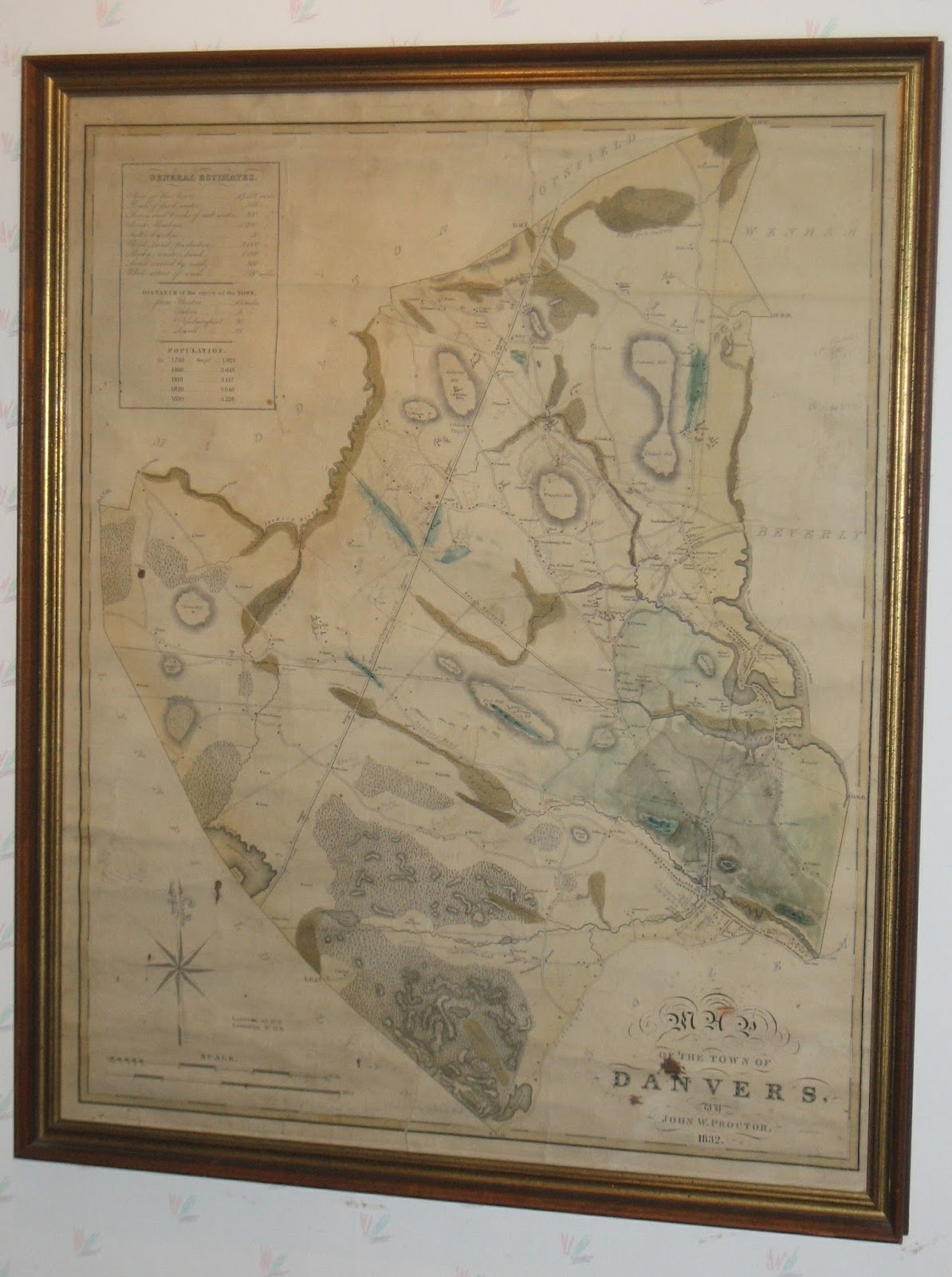

The map was made by John W. Proctor, 1832.

The upper left corner of the map includes a panel titled General Estimates:
Area of the Town .........17,112 acres
Ponds of fresh water 166 acres
Rivers and creeks of salt water ....... 300 acres
Fresh meadows ....1,200
Salt marshes.... 50
Wood Land (productive)... 3,000
Rocky (waste) Land ... 4,000
Land covered by roads ... 480
Whole extent of roads ... 80 miles.
-------------------------------------------
Population:
1783, Sept 1,921
1800 2,643
1810 3,127
1820 3,646
1830 4,228
1 comment:
May 2018 update:
I have found a small letter on Peabody Historical Society letterhead, dated Sept. 26, 1915, to my great grandfather Andrew Nichols inviting him to come talk about this map.
"Dear Mr. Nichols,
At a meeting of the Directors of our Society held last Thursday to arrange a calendar for this winter, it was unanimously voted to ask you to give us a talk on the 1832 map of Danvers, presumably on some part of it included in the present town of Peabody.
Miss Poole thinks that her father, Arthur F. Poole, will talk to us at the annual meeting in May on some part between Peabody Sq. and Salem line. I wonder if you can tell us of Central street, or any other part, of the people who lived in the then houses, who they were and what they did. It seemed to us that with your knowledge of the town, you can give us a very interesting talk. ... Can you speak to us on Tuesday evening Dec. 14th? ... "
I wonder if he agreed to speak, and if so, whether there is any report of his talk.
Post a Comment