Wednesday, August 28, 2013

1832 Danvers map

Here's a closeup of an old Danvers map that hangs on my wall.  The date on the printed map is 1832. The pencil annotations are undated, but most likely were added by my great-grandfather Andrew Nichols, a surveyor and civil engineer who in 1861 built a cottage at 98 Preston Street and raised his family there.  He lived until 1921.

This image helped me as I wrote the ending of my previous post --describing where Nichols Street used to run.

Compare this image with the photos in my previous post.  The straight road running from SW to NE is the Newburyport Turnpike (Route 1).  The CVS now at the corner of Rte 1 and Conifer Hill Drive sits right where the home of "J.Nichols" is marked on this map.  That was the farm house of Andrew's uncle and aunt, with whom he lived and for whom he worked as a young man.

Dale's Hill is drawn to the right -- resembling a fuzzy caterpillar. Just south of that hill another "Nichols" home is marked, and an "Elm Tree." There was a huge elm near the entrance gate to the Locust Lawn estate.  (See old photo I posted in March).


Here is a view of the 1832 map as it hangs in my home.  Click on the image to enlarge it. (Or see the links in my next blog entry.)


The map was made by John W. Proctor, 1832.


The upper left corner of the map includes a panel titled General Estimates:

Area of the Town .........17,112 acres
Ponds of fresh water           166 acres
Rivers and creeks of salt water ....... 300 acres
Fresh meadows ....1,200
Salt marshes....    50
Wood Land (productive)...    3,000
Rocky (waste) Land ...       4,000
Land covered by roads ...    480
Whole extent of roads ...      80 miles.
   -------------------------------------------

Population:

1783, Sept   1,921
1800      2,643
1810      3,127
1820      3,646
1830      4,228

Tuesday, August 27, 2013

Conifer Hill update

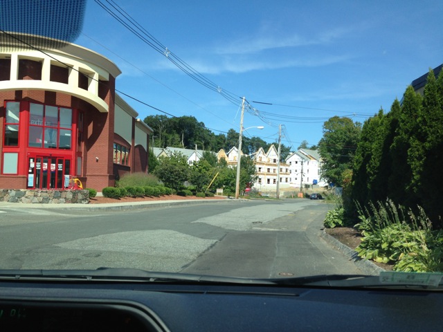
On Sunday afternoon August 25, 2013, I had an opportunity for a quick ride through Danvers. We drove north on Rte 1 and approached the familiar area of my childhood.  I spotted the red Putnam Pantry Candies building ahead on the right -- a meaningful landmark at the intersection of Rte 62. That building hasn't changed much, but most of the other landmarks I knew in the 1950's and 1960's are long gone.

The Danvers Liquor Store at the next intersection has now been replaced by a large CVS store. We turned right onto the street there, the old street of my childhood. In my mind's eye I can see my father's shop, my grandfather's house, our little house (#120) where I lived for my first 14 years, and then the bigger house (#121) up on the hill that was my home base for years. Even after I had married and moved away, I returned to visit my parents there.  I can visualize those old places so clearly!


But the scene is very different today. Nichols Street has been renamed Conifer Hill Drive, and a huge new housing complex called Conifer Hill Commons is under construction.  I had seen the construction site in April, noted the dramatic re-shaping of the hill, and pondered the fate of the trees on the narrow ridge. Now I was curious to see what was emerging.


I picked up a rental application form at the main gate and learned that applications received by August 16 would qualify for the initial lottery for the property -- that lottery to be held on Tuesday, August 27, 2013.  TODAY!


The address of Conifer Hill Commons is 121 Conifer Hill Drive. Its entrance drive is located right where Nichols Street and Speedwell Place used to intersect, right where our driveway to 121 Nichols Street began. But our driveway was a new construction in 1957, cutting through the old stone wall of the Locust Lawn property to provide convenient access to the new house we were constructing there. 

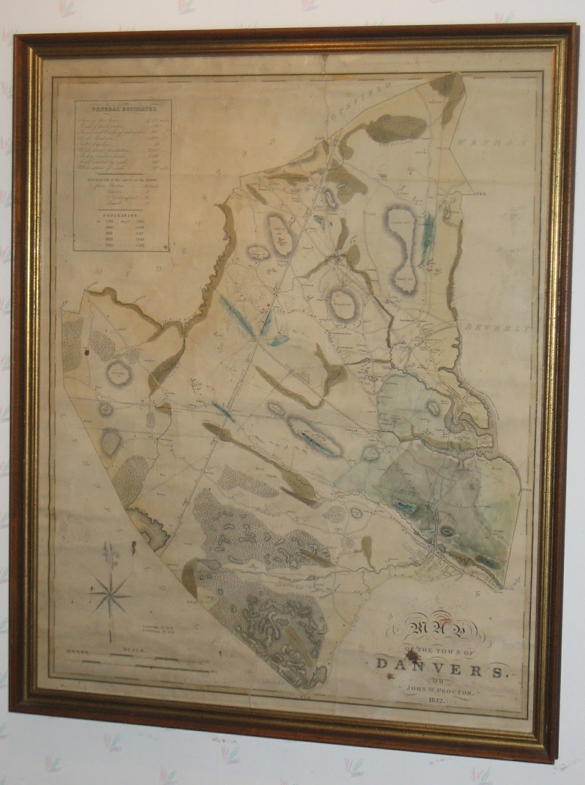
Earlier generations would describe it differently. That location is where Preston Street once ended, intersecting with Nichols Street, which in those days continued straight north over the side of Nichols Hill (or Dales Hill) towards its eventual connection to Ferncroft Road.  (In my next post I'll share images of an early map.)  Even I remember walking up that unpaved section of Nichols Street through the thick woods and then emerging into an open slope facing northwest towards Ferncroft.  I also remember when my grandparents' address, just around the corner, was 123 Preston Street.  At some point (perhaps during the 1949/50 reconstruction of Rte 1 to reduce hills and eliminate the stop light at Rte 62), the Preston Street crossing of Route 1 was blocked and the "orphaned" piece of Preston Street east of Rte 1 was re-named Nichols Street. My grandparents' address had to change to 124 Nichols Street, though they didn't move at all.  The formerly straight Nichols St then bent around the corner at our house, leaving "orphaned" the northward unpaved segment (which no longer connected across Rte 1 to Ferncroft, so it was little used.)  That bend is still recognizable today. New stonewalls have been built to replace the old ones, I'm happy to report. 

Given this history, I can certainly understand why the Nichols Street segment I knew so well now has a new name. Route 95 had cut it off from the lower section of Nichols Street, so it too became a disconnected fragment, or orphan.  


Monday, August 26, 2013

Ice cream on 114

Yesterday I attended the Antique & Classic Boat Show in Salem, and then stopped at Chandlers on Route 114 for ice cream.  I enjoyed a huge cone of peppermint stick ice cream while my husband savored a hot fudge sundae.


Stopping along 114 for ice cream was a strong tradition in my family.  My father especially liked ice cream, and he frequently traveled this route to and from Marblehead, where he raced his 16' sloop PAL.  I often was part of his sailing crew.  If we had won the race that day, we needed to stop, of course, and celebrate with ice cream.  If we had lost the race, my father said we needed ice cream to compensate, and to lift our spirits.


Sometimes we stopped at Treadwell's and sometimes we stopped at Chandler's. We enjoyed the ice cream cones at both places.  I'm delighted to see that both are still in business on this well-travelled route to Danvers. (Both are located in Peabody.)

Thursday, August 22, 2013

Danvers Archival Center

The Danvers Archival Center has recently redone their website, which you can find at www.danverslibrary.org/archive/

I recommend the article, "Discovering Paul Revere in a Dried Prune Box," written by Richard Trask, Town Archivist.   I enjoyed reading it, and thought of my experiences peering into dusty old boxes long stored in attics.

One never knows what treasures or curiosities will emerge.

A few weeks ago while looking for something else, I happened to find a folder of papers related to my summer employment in 1962.  Why did I still have that old paperwork?  Opening one folded sheet of paper, I saw the clear instruction on the top line: KEEP CARBON COPY FOR YOUR RECORDS. I guess I followed that instruction pretty well!  That old piece of paper jogged my memory, triggering a column topic for this month: "Creating with carbon paper."

I haven't had time this month to continue the sorting of old family papers (see previous post). In fact several months may pass before I'll have time to indulge in reading the old family writings.  I know those boxes contain much Danvers history.  I'll certainly stay in contact with the Danvers Archival Center to share information about any Danvers-related 'treasures' I find in the process.